Science on the Map: Places in New Zealand Named After Scientists
Garry J. Tee
In 1651, Giambattista Riccioli named many features on the Moon after scientists.1 As a mathematician he admired Nicholas Copernicus's mathematical astronomy—but as a Jesuit he could not accept the reality of Copernicus's system. Tycho Brahe likewise had admired Copernicus, but rejected his system on religious grounds. Consequently, Riccioli named the most conspicuous crater on the Moon as Tycho, and he named a smaller crater as Copernicus.
In recent decades, some asteroids and some places on Mars have been named after scientists.
Captain James Cook
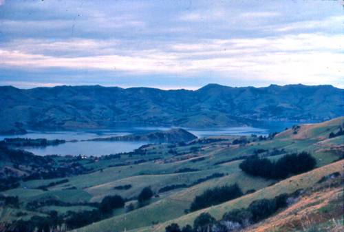
It was in New Zealand that places on Earth first got named after scientists. Captain James Cook F.R.S. (1728–1779) was a scientific explorer, and his first expedition on HMB Endeavour included the English botanist Joseph Banks F.R.S. (1743–1820, P.R.S. from 1778–1820) and his mentor and friend the Swedish naturalist Daniel Solander F.R.S. (1733–1782). In 1770 Cook named Banks Island (later found to be a peninsula) at (43° 44') South, (172° 52') East, and a rocky islet south of Fiordland at (46° 35') South, (166° 54') East, 380m altitude, was named Solander Island.23
All latitudes (South) and all longitudes (East) given here are taken from the Gazetteer of New Zealand Place Names or the Reed New Zealand Atlas (with its gazetteer). For any extended feature (e.g. mountain range or river) some representative point has been chosen. Altitudes (in metres) are taken from that Reed Atlas.
In New South Wales in 1770, Cook named Botany Bay in honour of the many botanical specimens collected by Banks and Solander, and he named the south headland as Solander Point and the north headland as Cape Banks. On Cook's second expedition, after the very first cruise in Antarctic waters, he stayed at Dusky Bay for rest and recuperation from 1773 March 26 to May 11. The astronomer William Wales F.R.S. (c. 1734–1798) constructed an observatory where he made very accurate observations of latitude, longitude and tides. Cook named the site (45° 46' 166° 34') as Astronomers Point,4 and he named Mt Wales (45° 38' 166° 40' 972m) on Resolution Island. Johann Reinhold Forster F.R.S. (1729–1798) and his son Georg Forster F.R.S. (1754–1794) both from Germany, and Anders Sparrman (1746–1820) from Sweden, were the expedition naturalists, and they are commemorated by Forster Burn (45° 14' 167° 22'), Mt Forster (45° 41' 166° 46' 1137m) and Mt Sparrman (45° 48' 166° 38' 989m).
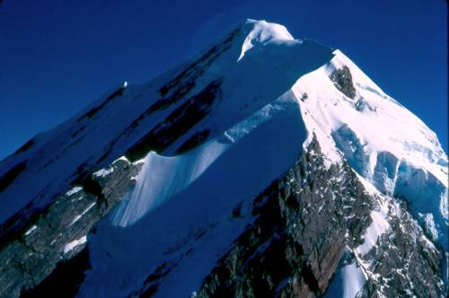
After Cook's second voyage, Captain James Cook and William Wales were both elected F.R.S. The strait separating the two largest islands of New Zealand became called Cook Strait (41° 24' 174° 36'), and in 1851 the hydrographer John Lort Stokes named the highest mountain in New Zealand as Mt Cook (43° 36' 170° 08' 3754m).5
James Cook and the astronomer Charles Green had observed the Transit of Mercury at Whitianga on 1769 November 9 (or November 10 if we apply the International Date Line, which had not been invented then), and that event is commemorated by the names of Cook's Bay (36° 50' 175° 45') and Cook's Beach (36° 50' 175° 43'). Other places in New Zealand (and elsewhere) have been named after Captain Cook:
- Cook Bluff (43° 27' 169° 46')
- Cook Channel (45° 47' 166° 37')
- Cook River (43° 26' 169° 48')
- Cook Saddle (43° 27' 170° 04')
- Mt Cook Range (43° 36' 170° 08')
Names Bestowed by Navigators
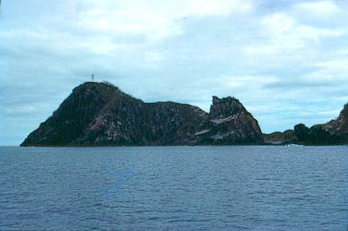
Following Captain Cook, some later navigators named places after scientists. The Spanish scientific expedition (1789–1794), commanded by Alejandro Malaspina (1754–1810), visited Doubtful Sound on 1793 February 25. Malaspina named the Nee islets (45° 15' 166° 52') after the expedition's botanist Luis Neé (1734–1807), and part of Doubtful Sound is called Malaspina Reach (45° 21' 167° 02'). In 1809 Captain John Grono (from Sydney) was hunting seals in Fiordland, and he named Bligh Sound (44° 46' 167° 29') after Captain William Bligh F.R.S. (1754–1817).6 On 1827 February 20, the French explorer Dumont d'Urville named a rocky islet east of the Colville Channel as Cuvier Island (36° 26' 175° 46' 274m), after the eminent French anatomist and palæontologist Georges Cuvier F.R.S. (1769–1832).7 Cuvier Lighthouse is an important navigational aid for ships around the Auckland region.
James Clark Ross F.R.S. (1800–1862), Robert FitzRoy F.R.S. (1805–1865), James Everard Home F.R.S. (1798–1853) and Owen Stanley F.R.S. (1811–1850) were Royal Navy captains with strong scientific interests, who were active in New Zealand around 1840. Ross studied geomagnetism, FitzRoy was a hydrographer, Home sent very many botanical specimens to Kew Gardens, and Stanley was a hydrographer.
On Ross's Antarctic Expedition (organized by the British Association for the Advancement of Science), Joseph Dalton Hooker P.R.S. (1817–1911) was the surgeon–naturalist on HMS Erebus and David Lyall was the surgeon–naturalist on HMS Terror. In 1840, Ross named Hooker Hill (50° 33' 166° 09' 437m) on Auckland Island, and Hooker Stream (52° 29' 169° 12') and Mt Lyall (52° 32' 169° 10' 413m) on Campbell Island. Port Ross (50° 32' 166° 11') in the Auckland Islands is named after Captain Ross. The expedition penetrated the pack–ice, and Ross named several places in Antarctica after scientists, including Hooker and Lyall.
In 1841 Governor William Hobson decided to abandon the capital which he had started at Russell and establish a capital Auckland at Tamaki, and he sent Captain Owen Stanley to make a hydrographic survey of Waitemata Harbour.8 That is commemorated by Stanley Point (36° 49' 174° 47') with Stanley Bay on the north shore of the Waitemata Harbour. (In 1850 Owen Stanley discovered the large mountain range in New Guinea which is named after him.)9 Captain James Everard Home is commemorated by Home Point (35° 19' 174° 23'), east of Whangaruru Harbour.10 Captain Robert FitzRoy was Governor of New Zealand (1843–1845), and Port FitzRoy (36° 10' 175° 22') on Great Barrier Island was named after him.
Names Bestowed by Surveyors and Scientists
The German naturalist Ernst Dieffenbach (1811–1855) was Naturalist to the New Zealand Company from 1838 to 1841. In 1839, the western tip of Arapawa Island was named Dieffenbach Point (41° 14' 174° 08'). (That is mis-spelled as Deiffenbach Point in the Reed Atlas and in its Gazetteer.) On 1839-12-25 Dieffenbach (with James Heberly) made the first ascent of Mt Egmont, and he was commemorated by Dieffenbach Cliffs or Bluffs in Egmont National Park.11 In 1841, Dieffenbach and Captain William Cornwallis Symonds (1810–1841) travelled overland from Auckland to Lake Taupo and Rotomahana, and Symonds in his journal (18415-15) named several hot springs at Tokaanu (southwest corner of Lake Taupo) after 'the most celebrated chemists'. Symonds drowned in Manukau Harbour on 1841-11-23, and Symonds Street in Auckland was named after him. Symonds's journal was not published, but a copy transcribed by Dr Thomas Morland Hocken is held in the Hocken Library, giving the names bestowed on hot springs as: Sir Humphry Davy, Gay–Lussac, Faraday, Graham, Thomson's, Liebig, Arago, Berzelius, Mitscherlich.12
Some French settlers arrived at Akaroa in 1840, and from 1840 to 1843 two French ships successively were based there to support the colony, with M. E. Raoul as surgeon. Raoul made extensive studies of New Zealand botany, and consequently the botanist Joseph Dalton Hooker P.R.S. (1817–1911) named the genus Raoulia in his honour, and the botanist Thomas Frederick Cheeseman (1846–1923) re-named the largest of the Kermadec Islands as Raoul Island (29° 16' 182° 04').13 (The gazetteer in the Reed Atlas gives the longitude of that volcanically active island in the form [77° 56' West].)
James Hector F.R.S. (1834–1907) dominated science in New Zealand from 1867 to 1903. He was commemorated in the North Island by Mt Hector (40° 57' 175° 17' 1529m) in the Tararua Range, and several places in the South Island were named after him.
European settlement increased rapidly after 1840, and the settlers gave European names to many places where they lived, retaining many Maori names. Much of the North Island was quickly named, and the only places named after scientists there are Home Point, Stanley Bay, Stanley Point, Cook's Bay, Cook's Beach, Dieffenbach Cliffs and Mt Hector. The city of Napier is named not after the great Scottish mathematician John Napier (1550–1617), but after one of his descendants, who was a mercenary for The Honourable East India Company in the 1840s.
Much of the South Island is thinly settled or uninhabitable, and hence after the early European settlement the later explorers, surveyors, geologists et al. were able to name many places. Consequently, the South Island has more places named after scientists than any comparable area on Earth. And similarly, many places in Antarctica have been named after scientists, starting with James Clark Ross in 1840.
Julius von Haast
Julius von Haast F.R.S. (1822–1887) was born in Bonn, and he arrived in Auckland on 1858 December 21, to become agent of a shipping company. He wrote a German prose-poem, lamenting that he had achieved nothing and his life was over at the age of 36. The next day the Austrian frigate Novara arrived on a scientific expedition around the world, with the German geologist Ferdinand von Hochstetter (1829–1884) as one of the scientists. Hochstetter was invited to make geological surveys for the Provincial Governments of Auckland and of Nelson, and he engaged Haast as his assistant.14 On 1859 October 2, Hochstetter left for Vienna, and the Nelson Provincial Government engaged Haast to make further surveys.
Haast explored the very rugged territory as far south as the Grey River and Lake Brunner, under extremely difficult conditions.15 In that topographical and geological survey he named many features after scientists, which appear on his 1860 map .16
- Buckland Peak (41° 53' 171° 30' 1288m), with Buckland Stream, was named after the geologist William Buckland F.R.S. (1784–1851)
- Mt Davy (42° 33' 171° 21' 1012m) was named after the chemist Humphry Davy P.R.S. (1778–1829)
- Mt Herschel (41° 28' 171° 50' 1448m) was named after the astronomer William Herschel F.R.S. (1738–1822)
- Lake Hochstetter (42° 27' 171° 40') was named after Haast's friend Ferdinand von Hochstetter
- Mt Hooker (now Mt Kemp, [42° 20' 172° 08' 1623m]) was named after the botanist Joseph Dalton Hooker P.R.S. (1817–1911)
- Mt Humboldt (42° 11' 172° 37' 2217m) was named after the German explorer and naturalist Alexander von Humboldt F.R.S. (1769–1859)
- The adjacent mountains Mt Hutton (41° 54' 172° 37' 1400m) and Mt Playfair (41° 52' 172° 36' 1138m) celebrate the pioneering Scottish geologists James Hutton (1726–1797) and John Playfair F.R.S. (1748–1819)
- Mt Lyell (41° 46' 172° 04' 1092m), Lyell Range (41° 43' 172° 08'), Lyell Creek (41° 48' 172° 03'), Lyell Chasm 17 and the (later) settlement of Lyell (41° 48' 172° 03') commemorate the Scottish geologist Charles Lyell F.R.S. (1797–1875)
- Mt Mantell (41° 59' 172° 17' 1606m) was named after the discoverer of dinosaurs Dr Gideon Algernon Mantell F.R.S. (1790–1852)
- Mt Mueller (42° 22' 172° 18' 1630m) was named after the Australian botanist Ferdinand von Mueller F.R.S. (1825–1896)
- The Scottish geologist Roderick Impey
Murchison F.R.S. (1792–1871)
is commemorated by many places around the world including:
- Mt Impey (41° 45' 173° 16' 1472m)
- Mt Murchison (41° 44' 172° 30' 1469m) with the River Murchison
- the (later) settlement of Murchison (41° 48' 172° 20')
- Mt Newton (41° 43' 172° 17' 1358m) celebrated the supreme scientist Isaac Newton P.R.S. (1642–1727)
- Mt Owen (41° 33' 172° 33' 1878m), with the River Owen, was named after the palæontologist Richard Owen F.R.S. (1804–1892)
- Sabine River (41° 54' 172° 41') was named after the geodesist Edward Sabine P.R.S. (1788–1883)
- Mt Werner (now named Mt Newcombe), (42° 36' 171° 50' 1337m) was named after the German mineralogist Abraham Gottlob Werner (1749–1817)
Haast also commemorated the physicist Michael Faraday F.R.S. (1791–1867) by Mt Faraday (42° 03' 171° 30' 1485m), which is neither on his 1860 map nor in his Nelson Report. And later he named Hochstetter Cave (alongside Moa Cave) in Aorere Valley.18
Haast's assistant James MacKay named Mt Haast (42° 17' 172° 05' 1597m)19 and Mt Hochstetter (42° 31' 172° 01' 1567m).20
Haast became Provincial Geologist to Canterbury Province from 1861 to 1868, during which period he explored much of Canterbury and South Westland. Haast was constantly under attack by politicians, ratepayers and newspaper editors who resented money being wasted on science—the Geologist had been appointed to find gold in Canterbury, and he had not done that!
Haast continued to name places after scientists–and that proved to be a very effective way to make himself known to scientists throughout the world, and gain their public support. On 1862 June 9 he wrote to the eminent botanist William Jackson Hooker F.R.S. (1785–1865, father of Joseph Dalton Hooker P.R.S.), telling him of a large glacier (43° 40' 170° 07') which he had named the Hooker Glacier, with the Hooker River:21
Geological Survey Office,
Christchurch,
Canterbury, N.Z.,
9th June, 1862.Sir William,
When beginning with the survey of the Southern Alps of New Zealand, hitherto entirely unknown, I proposed myself to create a kind of Pantheon or Walhalla for my illustrious contemporaries amongst those never-trodden peaks and glaciers, and I had, therefore, the pleasure to call a magnificent glacier, three-quarters of a mile broad at its terminal face, and descending from the south-western side of Mount Cook, the Hooker glacier, and the river issuing from its icy vault, the River Hooker. It falls into the Tasman River, which latter forms Lake Pukaki, without doubt one of the most splendid alpine lakes in the known world. I would have chosen a mountain had I not already named in the Nelson Province a high range on the right bank of the river Grey, the Hooker Range, in honour of your son, Dr. J. Hooker, as the author of our admirable flora.
I have the intention to send you shortly a map of this wilderness, accompanied by water-colour drawings, to Dr. J. Hooker. You will become better acquainted with the general features of your Godchild, and you will confess that our Alps can not only rival(ise) but surpass the European Alps in many respects. My harvest of alpine plants was very considerable, of which I shall have the pleasure to entertain Dr. Jos. Hooker. Believe me, Sir William, with deep respect,Very faithfully yours,
Julius Haast.To Sir Will. Hooker, Bart. F.R.S.,
Director of the Royal Botanical Gardens, etc., Kew.
The massive biography of Haast by his son H.F. von Haast devotes Chapter 69 to Haast's Nomenclature. 'Haast gave over one hundred names; and, despite ignorance on the part of the authorities of the contribution to the world's knowledge made by those commemorated, and of anti-German fanaticism during World War 1, the great majority of the names have remained upon the map.'22
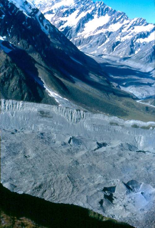
In Canterbury and Westland, Haast named many places after scientists. He named the Agassiz Range (43° 08' 171° 07'), and the glacier feeding into the Callery Glacier was named after the Swiss geologist Louis Agassiz F.R.S. (1807–1873). But that glacier is now regarded as part of the Callery Glacier, and the name of Agassiz Glacier has been transferred to the glacier (43° 30' 170° 13') feeding into Franz Josef Glacier. The Scottish physicist David Brewster F.R.S. (1781–1868) was commemorated by Mt Brewster (44° 04' 169° 27' 2423m) with Brewster Glacier.
The German physiologist Karl Gustav Carus (1789–1869) was commemorated by Mt Carus (later re-named) at the head of the Mathias River, and the Clarke River (43° 50' 169° 31'), which flows into the Haast River, was named after the Australian geologist Rev. William Branwhite Clarke F.R.S. (1798–1878). Mt Dana (44° 06' 169° 13' 1600m) was named after the American geologist James Dwight Dana F.R.S. (1813–1895) who had witnessed the signing of the Treaty of Waitangi, as one of a group from the United States Exploring Expedition. Mt Darwin (43° 32' 170° 20' 2952m), with Darwin Glacier, celebrated the supreme naturalist Charles Robert Darwin F.R.S. (1809–1882).
Mt Elie De Beaumont (43° 29' 170° 20' 3117m) was named after the French geologist Elie De Beaumont (1798–1874).
Forbes River (43° 28' 170° 42') and Mt Forbes were named after the Scottish geologist James David Forbes F.R.S. (1809–1868)—but Haast later re-named that peak as Mt D'Archiac (43° 28' 170° 35' 2866m) after the French geologist Vicomte D'Archiac (1802–1868), and the name Mt Forbes has been transferred to a lower peak (43° 30' 170° 36' 2591m) south of Mt D'Archiac. A glacier feeding Cass River was named Faraday Glacier (43° 37' 170° 24') after Michael Faraday F.R.S. (1791–1867). Haast named Haast Pass (44° 06' 169° 21') and Haast River (44° 15' 168° 07') after himself 'according to the direction of His Honour the Superintendent', and the later settlement (at [43° 53' 169° 03']) near the mouth of the Haast River got named as Haast.
Mt Haidinger (43° 33' 170° 12' 3066m) was named after the Austrian geologist William von Haidinger F.R.S. (1795–1871). Hochstetter Glacier (in Westland/Toi Poutipi National Park),23 was named after Haast's friend Ferdinand von Hochstetter; and Mt Hooker (43° 50' 169° 40' 2652m) with another Hooker Glacier, and the Hooker Range (43° 44' 169° 56') were named after Joseph Dalton Hooker P.R.S. (1817–1911). The mathematician and geologist William Hopkins F.R.S. (1793–1866) was commemorated by Hopkins River (44° 06' 169° 52'). The biologist Thomas Henry Huxley P.R.S. (1825–1895) was commemorated by Mt Huxley (44° 04' 169° 41' 2499m), with the Huxley River, and a glacier close to Faraday Glacier was named Huxley Glacier (43° 56' 170° 24'). The geologist Joseph Beete Jukes F.R.S. (1811–1869) was commemorated by Mt Jukes (43° 40' 170° 20' 2623m), the German chemist Justus von Liebig F.R.S. (1803–1873) was commemorated by the Liebig Range (43° 47' 170° 21'), and the Scottish geologist Charles Lyell F.R.S. (1797–1875) was commemorated by the Lyell Glacier (43° 18' 170° 51'). The McCoy Stream (43° 22' 170° 47') was named after the Australian palæontologist Frederick McCoy F.R.S. (1823–1899), and the Mueller Glacier (43° 44' 170° 02') was named after the Australian botanist Ferdinand von Mueller F.R.S. (1825–1896). Murchison Glacier (43° 34' 170° 23'), with Murchison River were named after the geologist Roderick Impey Murchison F.R.S. (1792–1871).
The Naumann Range (separating the Dobson and Hopkins rivers) was named after the German mineralogist Karl Naumann F.R.S. (1797–1873)—both the Gazetteer of New Zealand Place Names and the Reed Atlas mis-name that as Neumann Range. The Scottish geologist Andrew Crombie Ramsay F.R.S. (1814–1891) was commemorated by Ramsay Glacier (43° 16' 170° 55') and the Ramsay Range (43° 16' 170° 53').
Dr Andrew Sinclair (c. 1796–1861) was a Scottish doctor with a strong interest in botany. He was the Colonial Secretary of New Zealand from 1844 to 1856, when he sent many botanical specimens to Joseph Dalton Hooker. He retired to England, where he discussed scientific matters with Charles Darwin and Thomas Henry Huxley, and he returned to New Zealand in 1858 to collect further botanical specimens. Three friends of Charles Darwin were directly involved in the tragic event of 1861 March 25 when Dr Sinclair, exploring with Haast, was drowned in the Rangitata River on Samuel Butler's sheep station Mesopotamia. Haast commemorated him with Mt Sinclair (43° 39' 170° 49' 2065m), the Sinclair Range (43° 41' 170° 49') and Sinclair River (43° 25' 170° 49'). Auckland University College was founded in 1883, and in 1884 the Sinclair Scholarship in biology was founded in honour of Dr Andrew Sinclair.
Haast named a mountain range, a peak and a pass as Malte Brun—not after the Danish geologist Conrad Malte Brun but after his son the geographer Victor Adolph Malte Brun.24
Twenty-nine years after Haast wrote his poem of despair in Auckland, he died in 1887 at the age of 65. He had become a famous geologist who was a Fellow of the Royal Society of London, Honorary Doctor of Tübingen University and Cambridge University, knight of the British Empire and of the Austro–Hungarian Empire etc. He was much esteemed by many scientists around the world-including many whose names he had put on the map of New Zealand.
James McKerrow
James McKerrow (1834–1919) studied mathematics at Glasgow University, and in 1859 he became deputy-surveyor for Otago province. In his explorations of the Otago lakes district from 1861 to 1864, he named many places in Otago after scientists.25
- Mt Ansted (44° 30' 166° 37' 2344m) was named after the Scottish geologist David Thomas Ansted F.R.S. (1814–1880)
- Dana Peak (45° 13' 167° 36' 1722m) was named after the American geologist James Dwight Dana F.R.S. (1813–1895)
- A second Mt Forbes (43° 30' 170° 35' 2591m) was named after the Scottish geologist James David Forbes F.R.S. (1809–1868)
- The Hector Mountains (45° 16' 168° 50') were named after James Hector F.R.S. (1834–1907)
- The Humboldt Mountains (44° 44' 168° 16') and Humboldt Tower (44° 29' 168° 33' 2222m) were named after Alexander von Humboldt F.R.S. (1769–1859)
- Cosmos Peak (44° 34' 169° 18' 2260m) was named after Humboldt's major work of scientific synthesis Cosmos
- Mt Bonpland (44° 50' 168° 17' 2348m) was named after Humboldt's colleague the French botanist Aimé Bonpland (1773–1858)
The Kepler Mountains (45° 22' 167° 25' ), west of Lake Te Anau, commemorate the great German astronomer Johannes Kepler (1571–1630). In 1991, Pathfinders Publications (1974) in Christchurch published a map Pathfinders New Zealand on one folding sheet, which names those mountains as KELPER MTS!
- A second Mt Lyall (45° 17' 167° 32' 1905m) was named after the surgeon–naturalist David Lyall
- Mt Maury (45° 20' 167° 30' 1570m) was named after the American oceanographer Matthew Maury (1806–1873)
- The Scottish geologist Hugh Miller (1802–1856) was commemorated by Miller Peak (45° 10' 167° 35' 1503m)
- The Murchison Mountains (45° 15' 167° 32') were named after the geologist Roderick Impey Murchison F.R.S. (1792–1871)
- Lake Thomas (45° 28' 167° 57') was (later) named after Algernon Phillips Withiel Thomas (1857–1937), the foundation Professor of Natural Sciences at Auckland University College
- Tyndall Peak (44° 32 168° 32' 2457m) was named after the Irish physicist John Tyndall F.R.S. (1820–1893).
After Haast and McKerrow
In 1874, the French expedition to Campbell Island (imprudently sent there to observe the Transit of Venus) named:
- Mt Dumas (52° 34' 169° 06' 504m) after the President of the Commission for the Transit of Venus the physicist Jean Dumas F.R.S. (1800–1884)
- Mt Fizeau (52° 31' 169° 10' 472m) after the physicist Armand Fizeau F.R.S. (1817–1876)
- Puiseux Peak (52° 36' 169° 10' 403m) after the astronomer Victor Puiseux (1820–1883)
- Filhol Peak (52° 35' 169° 08' 287m) after the expedition doctor and naturalist Henri Filhol (1843–1902)26
- Yvon Villarceau Peak (52° 32' 169° 02' 336m) after the astronomer Joseph François Yvon Villarceau (1813–1883) on the Transit Commission.27
The German zoologist Robert von Lendenfeld (1858–1913), a leading researcher on sponges, worked in Australia and New Zealand in the 1880s, classifying the sponges. Lendenfeld and his wife visited Haast in 1883, and then they became pioneers of mountain-climbing in the Southern Alps.28 He named
- Mt Haast (43° 34' 170° 11' 3138m) after Julius von Haast
- Haeckel Peak (43° 32' 179° 21' 2941m) after the German zoologist Ernst Haeckel (1834–1919)29
- Hochstetter Dome (43° 30' 170° 21' 2822m), with Hochstetter Glacier and Hochstetter Icefall, after Ferdinand von Hochstetter (1829–1884). 30
Robert von Lendenfeld is commemorated by Lendenfeld Peak (43° 34' 170° 10' 3201m), and Lendenfeld Saddle (43° 30' 170° 20' 2436m) over the Southern Alps.
In 1931, R. Speight named Mt Cheeseman (43° 10' 171° 38' 2006m) after the botanist Thomas Frederick Cheeseman (1846–1923),31 and the volcanic islet Cheeseman Island (30° 32' 181° 25') in the Kermadec Islands was also named after him. (The gazetteer in the Reed Atlas gives the longitude of that volcanic islet in the form [178° 35' West].) The botanist Leonard Cockayne F.R.S. (1855–1934) was commemorated by Cockayne Glacier (43° 17' 170° 52') and Mt Cockayne (43° 08' 171° 40' 1847m). Davy Creek (41° 31' 172° 39') was presumably named after Humphry Davy P.R.S. (1778–1829); and on Resolution Island a third Mt Forbes (45° 48' 166° 41' 933m) was named after the geologist James David Forbes F.R.S. (1809–1868). Haast Range (44° 10' 168° 45) was named after Julius von Haast F.R.S (1822–1887). In the South Island, James Hector F.R.S. (1834–1907) is commemorated by the settlement of Hector (41° 36' 171° 53'), Hector Col ([44° 24' 168° 41'] which he discovered), Hector River (40° 58' 175° 23'), Hector's Stream (45° 08' 168° 26'); and in 1887 the collector Andreas Reischek32 named Lake Hector (45° 59' 168° 31'). Humboldt Creek (44° 42' 168° 08') was named after Alexander von Humboldt F.R.S. (1769–1859), and Mt Hutton (43° 36' 170° 23' 2850m) was named after the geologist Frederick Wollaston Hutton F.R.S. (1836–1905).
On Resolution Island the surgeon-naturalist David Lyall was commemorated by a third Mt Lyall (45° 38' 166° 41' 994m). Ferdinand von Mueller F.R.S. (1825–1896) was commemorated by Lake Mueller (43° 25' 170° 02'), Mueller Peak (43° 14' 170° 50' 2025m), Mueller River (44° 02' 168° 58'), and by Mueller Pass (43° 46' 169° 49') and another Mueller Pass (44° 03' 169° 13'). Mt Murchison (43° 00' 171° 33' 2400m) was named after Roderick Impey Murchison F.R.S. (1792–1871). Andrew Crombie Ramsay F.R.S. (1814–1891) was commemorated by Mt Ramsay (44° 01' 167° 27' 1636m) and another Mt Ramsay (43° 16' 170° 53' 2469m). Tyndall Creek (42° 54' 171° 15') was named after John Tyndall F.R.S. (1820–1893), and Volta Glacier (44° 22' 168° 47') was named after the Italian physicist Alessandro Volta F.R.S. (1745–1827).
In the South Island many places were named Franklin, not after Benjamin Franklin but after John Franklin, the Arctic explorer and Governor of Van Diemensland.
During World War 2, the New Zealand Government sent teams of coastwatchers to various islands. The teams sent to the Auckland Islands and Campbell Island, under the codename Cape Expedition, included some scientists, who took the opportunity to make scientific studies of those little-known subantarctic islands.33 In the Auckland Islands, the ornithologist Robert Alexander Falla (1901–1979) is commemorated by Falla Peninsula (50° 42' 166° 11'), the palæontologist Charles Alexander Fleming F.R.S. (1916–1987) is commemorated by Fleming Plateau (50° 46' 165° 57'), and the ornithologist Evan Graham Turbott (b. 1914) is commemorated by Turbott Lake (50° 54' 166° 03').
Paparoa Range
The Paparoa Range is a ridge close to the coast between Greymouth and Westport. The earlier account of Haast's 1860 map told that Haast had named Mt Davy at the southern end and Buckland Peak at the northern end, and he had named the highest point in the range as Mt Faraday. On various occasions since then, names of scientists have been attached to some local maxima along that range.
From south to north, there are:
- Mt Davy (42° 33' 171° 21' 1012m)
- Mt Lodge (42° 06' 171° 32' 1455m) named after the physicist Oliver Lodge F.R.S. (1851–1940)
- Mt Ramsay (42° 06' 171° 33' 1410m) probably named after the chemist William Ramsay F.R.S. (1852–1916)
- Mt Dewar (42° 06' 171° 33' 1433m) named after the physicist James Dewar F.R.S. (1842–1923)
- Mt Priestly (42° 04' 171° 33' 1394m) mis-spelt after the chemist Joseph Priestley F.R.S. (1733–1804)
- Mt Faraday (42° 03' 171° 30' 1485m)
- Mt Curie (42° 02' 171° 30' 1349m) named after the Polish physicist Marie Curie (1867–1934)
- Mt Mendel (42° 01' 171° 35' 1424m) named after the Moravian botanist Gregor Mendel (1822–1884)
- Mt Pasteur (42° 01' 171° 34' 1341m) named after the French biologist Louis Pasteur F.R.S. (1822–1895)
- Mt Einstein (42° 00' 171° 36' 1349m) named after the renowned German physicist Albert Einstein F.R.S. (1879–1955)
- Mt Euclid (41° 58' 171° 36' 1440m) named after the very famous Greek mathematician Euclid (c.-300)
- Mt Rutherford (41° 59' 171° 36' 1301m) named after the physicist Ernest Rutherford P.R.S. (1871–1938)
- Mt Fleming (41° 57' 171° 34' 1375m) named after the discoverer of penicillin Alexander Fleming F.R.S. (1881–1955)
- Mt Lavoisier (41° 56' 171° 35' 1369m) named after the French chemist Antoine-Laurent Lavoisier (1743–1794)
- Mt Kelvin (41° 56' 171° 37' 1434m) named after the Scottish physicist William Thomson P.R.S. Baron Kelvin (1824–1907), and Buckland Peak (41° 53' 171° 30' 1288m).
- Mt Copernicus (42° 00' 171° 46' 1149m) named after the great Polish astronomer Nicholas Copernicus (1473–1543)
- Mt Galileo (41° 56' 171° 43' 1265m) named after the major Italian physicist Galileo Galilei (1564–1642)
The geologist Simon Nathan added the names of Copernicus, Curie, Einstein, Euclid, Fleming, Galileo, Lavoisier, Mendel, Pasteur and Rutherford in 1971.34 For the peaks named after Fleming, Lavoisier, Mendel, Pasteur, and Rutherford, the latitude, longitude and altitude are taken from the topographic map NZMS 260 Sheet K30 Punakaiki.
Street Names
Street names can be consulted at Wises NZ on-line website www.wises.co.nz
Many streets are named after scientists—but several identifications are uncertain. For example, many streets are named Newton or Rutherford—but those names are not uncommon, and so those street-names cannot generally be presumed to refer to Isaac Newton or Ernest Rutherford. But in Ngaruawahia, Newton Street is close to other streets named after scientists, and so that is listed here. Some places named Kelvin were named after the stream Kelvin in Glasgow, from which the physicist William Thomson took his title of Baron Kelvin. But in Gisborne, Kelvin Street is close to other streets named after scientists, and so that is listed here.
In Auckland, Priestley Drive is joined by Wycherley Drive, Vanbrugh Place, Pinero Place, Galsworthy Place and Maugham Drive. Accordingly, Priestley Drive is named after the dramatist J. B. Priestley and not the scientist Joseph Priestley F.R.S. In Wanganui, Babbage Place was named not after the inventor of the computer Charles Babbage F.R.S. (1791–1871), but after his eldest grandson Charles Whitmore Babbage, who settled there in c. 1885.
- Kerikeri: Darwin Road.
- Dargaville: Haast Road.
- Albany: Beatrice Tinsley Avenue, William Pickering Drive.
- North Shore City: Cockayne Crescent, Sinclair Street.
- Auckland: Darwin Lane, Haast Street, Huxley Place, Pasteur Place, Solander Terrace.
- Manukau: Cavendish Drive, Dana Place, Dr Pickering Avenue, Lendenfeld Drive, Lyell Court, Priestley Drive.
- Thames: Davy Street.
- Ngaruawahia: Galileo Street, Kepler Street, Herschel Street, Newton Street.
- Cambridge: Priestley Place.
- Matarangi: Cuvier Crescent.
- Hamilton: Euclid Avenue.
- Tauranga: Tyndall Crescent, Solander Drive.
- Tolaga Bay: Solander Street.
- Gisborne: Boyle Place, Cavendish Crescent, Curie Place, Dalton Street, Darwin Road, Davy Place, Einstein Street, Halley Street, Herschell Road, Huxley Road, Kelvin Street, Owen Road, Pasteur Street, Pickering Street, Solander Street, Tyndall Road.
- Napier: Dalton Street, Darwin Crescent, Faraday Street, Herschell Street, Hooker Avenue, Lyell Road, Maxwell Place, Owen Street, Priestley Road, Priestley Terrace.
- Hastings: Lyell Street.
- New Plymouth: Darwin Crescent, Euclid Street.
- Kai Iwi: Herschel Street, Huxley Road.
- Palmerston North: Haast Place.
- Opunake: Dieffenbach Street.
- Pahiatua: Huxley Street.
- Carterton: Faraday Street.
- Lower Hutt: Euclid Grove, Haast Close.
- Porirua: Solander Place.
- Wellington: Cockayne Road, Darwin Street, Huxley Grove.
- Nelson: Rutherford Street.
- Havelock: Rutherford–Pickering Square.
- Brightwater: Lord Rutherford Road, Faraday Rise.
- Christchurch: Banks Street, Dana Place, Faraday Street, Haast Street, Hooker Avenue, Humboldt Street, Sir William Pickering Drive.
- Twizel: Huxley Place.
- Omarama: Huxley Terrace.
- Queenstown: Humboldt Lane.
- Timaru: Huxley Street.
- Dunedin: Mellor Street, Mellor Park.
Robert Boyle F.R.S. (1629–1691) was a pioneering chemist and physicist, Henry Cavendish F.R.S. (1731–1810) was a brilliant physicist and chemist, John Dalton F.R.S. (1766–1844) founded the modern theory of atoms, Edmond Halley F.R.S. (1656–1742) was one of the most versatile of scientists, John Herschel F.R.S. (1792–1871) was an important physicist and astronomer (son of William Herschel F.R.S. 1738–1822), James Clerk Maxwell F.R.S. (1831–1879) was a major physicist, Joseph William Mellor F.R.S. (1869–1938) was an eminent chemist, and Beatrice Tinsley (1941–1981) was a leading cosmologist.
Ernest Rutherford P.R.S. (1871–1938) was born at Brightwater; he attended school at the settlement of Foxhill (1877–1883) then at the small town of Havelock (1883–1887), and then Nelson College (1887–1889). At Havelock School in about 1918, little Billie asked the teacher why there was a bronze plaque on the wall naming Ernest Rutherford. He explained that Ernest Rutherford had been a pupil at Havelock School, and had become the greatest scientist in the world. 'Right!' said little Billie, 'I'm going to become a scientist'.35 And indeed, William Pickering (1910–2004) directed the exploration of the planets, from the Jet Propulsion Laboratory at CalTech. In 2003 he attended a ceremony at Havelock, when the town square was re-named as Rutherford–Pickering Square.
Antarctica
In 1840 James Clark Ross's Antarctic Expedition penetrated the pack
ice, and Ross discovered
the Ross Sea, Ross Island and the Ross Ice Barrier.On the north
coast of Antarctica, Ross named
Cape Gauss after the great German mathematician Carl Friedrich Gauss
F.R.S. (1777–1855), and
Smyth Head after the astronomer William Henry Smyth F.R.S.
(1788–1865).
In Victoria Land, from north to south Ross named:
- Cape Hooker and Lyall Islets
- Mt Sabine after the geodesist Edward Sabine P.R.S.(1788–1883)
- Mt Whewell after the philosopher of science William Whewell F.R.S. (1794–1866)
- Mt Herschel after John Herschel F.R.S. (1792–1871)
- Mt Peacock after the mathematician George Peacock F.R.S. (1791–1858)
- Mt Lloyd after the Irish physicist Humphrey Lloyd (1800–1881)
- Mt Harcourt after William Venables Vernon Harcourt F.R.S. (1789–1871) who was the principal founder of the BAAS
- Cape Wheatstone after the physicist Charles Wheatstone F.R.S. (1802–1875)
- Mt Brewster after the physicist David Brewster F.R.S. (1781–1868)
- Cape Daniell after the chemist John Daniell F.R.S. (1790–1845)
- Mt Lubbock after the astronomer John William Lubbock F.R.S. (1803–1865)
- Mt Murchison after the geologist Roderick Impey Murchison F.R.S. (1792–1871)36
Before the Antarctic Treaty came into effect, New Zealand had laid claim to the Ross Sea Sector of Antarctica, which includes all those places named by James Clark Ross.
Within that Ross Sea Sector there are:
- Ballance Peak named after the geologist Peter F. Ballance
- Benson Glacier named after the geologist William Noel Benson F.R.S. (1885–1957)
- Cape Bernacchi named after the physicist Louis Charles Bernacchi (1876–1942)
- Debenham Glacier named after the geologist Frank Debenham (1883–1965)
- Ferrar Glacier and Ferrar Valley named after the geologist H. T. Ferrar
- Mt Gunn named after the geologist Bernard Gunn
- Mt Guyon named after the geologist Guyon Warren
- Mt Hooker and Hooker Glacier named after Joseph Dalton Hooker P.R.S. (1817–1911)
- Mt Lister and Lister Glacier named after the surgeon Joseph Lister P.R.S. (1827–1912)
- Marshall Glacier named after the geologist Patrick Marshall (1869–1950)
- Mawson Glacier named after the Australian geologist Douglas Mawson F.R.S. (1882–1958)
- Miller Glacier named after the glaciologist Joseph Holmes Miller
- Odell Glacier named after the geologist N. E. Odell
- Mt Smith named after the geologist W. C. Smith
- Suess Glacier named after the geologist Eduard Suess F.R.S. (1831–1914)
- T. G. Taylor Glacier and Valley named after the glaciologist Thomas Griffith Taylor (1880–1963).37
Further names of scientists appear in the series of charts Geological Map of Antarctica. On Sheet 13, Northern Victoria Land there are Priestley Glacier named after the Australian glaciologist Raymond E. Priestley (1886–1974) and Lillie Glacier named after the geologist Arnold Lillie (1909–1999). On Sheet 14, Terra Nova Bay—McMurdo Sound Area there are David Glacier named after the Australian geologist T. W. Edgeworth David F.R.S. (1858–1934), Mt Suess named after the geologist Eduard Suess F.R.S. (1831–1914), E. A. Wilson Piedmont Glacier named after the physician and naturalist Edward Adrian Wilson (1872–1912), Mt Fleming at the head of Wright Valley named after the glaciologist W. L. S. Fleming, and the Upper Wright Glacier named after the glaciologist C. S. Wright by the 1961 TransAntarctic Expedition. On Sheet 15, Shackleton Coast there are Darwin Glacier and Mountain named after Charles Darwin F.R.S. (1809–1882), Cape Laird named after the geologist Malcolm Laird, Cotton Glacier named after the geomorphologist Charles Andrew Cotton (1885–1976), Marshall Mountains named after the geologist Patrick Marshall (1869–1950), Mt Falla named after the ornithologist Robert Alexander Falla (1901–1979), and Mt Darwin. On Sheet 16 there is Lillie Range named after the geologist Arnold Lillie (1909–1999), and on Sheet 17 there is Teller Peak named after the American physicist Edward Teller (1908–2003).
I have examined atlases of several countries and some gazetteers of world atlases. Various places are named after scientists in Australia, Canada, South Africa, Chile, Russia, USA et cetera. I have not attempted an exhaustive survey—but it seems probable that New Zealand has more places named after scientists than does all the rest of the world.
Acknowledgement
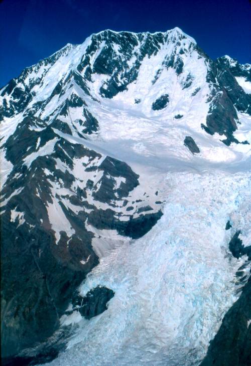
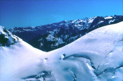
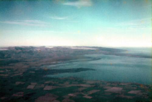
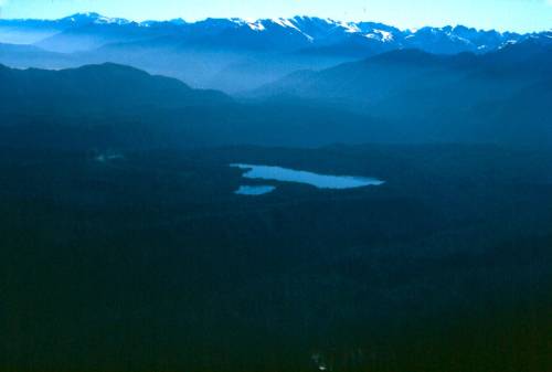
All photographs are the work of the author and appear with his permission.
References
Beasley, Arthur Wynyard (2000) Home Away From Home, Central Institute of Technology & Grantham House, Wellington.
Beattie, Herries (1948) Otago Place Names, Otago Daily Times & Witness Newspapers Co, Ltd, Dunedin.
Begg, A. Charles & Begg, Neil C. (1970) James Cook and New Zealand, Government Printer, Wellington.
Cheeseman, Thomas Frederick (1925) Manual of the New Zealand Flora, (2nd edition), Government Printer, Wellington.
(1968) Gazetteer of New Zealand Place Names, Government Printer, Wellington.
Gunn, Bernard M. & Warren, Guyon (1962) Geology of Victoria Land, between the Mawson and Mulock Glaciers, Antarctica, NZGS Bulletin 71.
Keam, Ronald Frank, personal communication.
Kerr, Ian S. (1976) Campbell Island: a History, Reed, Wellington.
Lubbock, Adelaide (1968) Owen Stanley R.N. 1811–1850 : Captain of the Rattlesnake, Heinemann, Melbourne.
McKenzie, D. W. (General Editor) (1995), Reed New Zealand Atlas, Reed Books, Auckland.
Nathan, Simon, personal communication.
Oliver, R. L. & Filhol, Henri (1843–1902), and Campbell Island,(1999) Geological Society of New Zealand Historical Studies Group Newsletter 18, 7–12.
Pickering, William (c. 1977) lecture at the University of Auckland.
Reed, A. W. (2002) Reed Dictionary of New Zealand Place-Names. Reed Books, Auckland.
Riccioli, Giambattista (1651) Almagestum Novum, Bologna. (not seen).
Ross, Sir James Clark A Voyage of Discovery and Research in the Southern and Antarctic Regions dots 1839–43 (2 volumes), J. Murray, London, 1847.
Turbott, Evan Graham (2002) Year Away: Wartime Coastwatching on the Auckland Islands, 1944, Department of Conservation, Wellington.
von Haast, Heinrich F. (1948) The Life and Times of Sir Julius von Haast K.C.M.G., Ph.D., D.Sc., F.R.S. Explorer, Geologist, Museum Builder, H. F. von Haast, Wellington.
Notes
1 Riccioli
2 Begg & Begg, p.71 & p.78
3 Begg & Begg, p.78
4 Begg & Begg, p.98
5 Reed p.97
6 Reed p.45
7 Reed, p.109
8 Lubbock, p.136
9 Lubbock, p.254
10 Beasley, p.132
11 Reed, p.117
12 Keam
13 Cheeseman, pp.xxiii–xxiv
14 Haast, Chapter 1
15 Haast, Chapters 8 & 9
16 Haast, Map No.1
17 Reed, pp.202–203
18 Reed, p.206
19 Haast, p.981
20 Reed, p.206
21 Haast, p.213
22 Haast, p.976
23 Reed, p.206
24 Haast, pp.450–452
25 Beattie
26 Oliver
27 Kerr, endpaper map
28 Haast, pp.847–848
29 Haast, pp.847–848
30 Reed, p.206
31 Reed, p.85
32 Reed, p.196
33 Turbott
34 Nathan
35 Pickering
36 Ross, v.1, map facing p.1
37 Gunn & Warren